Data & Insight
A city lab that maps the inner city in six themes, a simulator that tests a street change before it is built, and fieldwork on the ground, all built in-house.
A long-running programme reshaping the streets, squares, and public spaces of Cape Town's inner city.
About Data & Insight
Data is one of the three things the Mission does, alongside placemaking and destination marketing. It is not a reporting function bolted on at the end. It is how the work gets chosen, defended, and, when it is not working, changed.
The City Lab
Our main tool is a street-level urban intelligence platform for the inner city, built from scratch in eight months by Stefan le Roux and Anees Omar. There was no template to work from. The frontend is React and Mapbox; the data sits in a Google Cloud and PostGIS environment. It draws on satellite imagery, public databases, private data partners and our own fieldwork, and renders the result as an interactive map.
Six themes run across it: commerce, mobility, lighting, greenery, comfort and traffic. Comfort covers heat, wind, air quality and noise. Commerce alone carries a dozen layers: 3 626 operational businesses, Google ratings and reviews, street-vendor survey points, essential services, cultural amenities, property transactions, the residential pipeline sized by units and coloured by delivery stage, City photogrammetry building footprints, hotels and lodging, a shopfront-upgrade candidate list, and valid liquor licences. Around the themes sit workspaces for Pulse, Safety, Pedestrian, Climate, Nightlife, Parcels, Hospitality, Streets, Market and Compare.
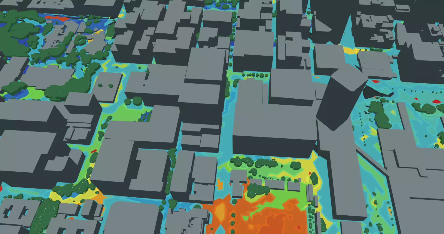
Much of what it shows cannot be seen from street level. The hottest place in the inner city is Tennant Street, where low buildings, no tree canopy and no wind corridor turn open asphalt into a solar oven. The largest cool zone is the Company’s Garden, which is why the Art Walk route was planned along that corridor. A sentiment layer reads public mentions of individual streets and scores them. The mobility layer showed that women avoid particular blocks at particular times of day, turning something widely felt into something addressable.
One night we walked from St George’s Mall to North Wharf Square with a 360-degree camera and light meters, mapping every dark spot: streetlights, shop lights, building lights, everything that adds to or subtracts from walking after dark. We sent the City the report. They fixed the lights that were out.
Crime is the gap. It is not published at a fine enough grain to be useful.
Conditions
Conditions is a city simulator. It takes a digital twin of the inner city, built from 2025 LiDAR, OpenStreetMap, municipal datasets and transport schedules, and lets you test a change before it is built rather than after.
Five lenses sit on the same 3D model. Heat finds hot surfaces and shade gaps. Sunlight traces shadows and sun hours through the seasons. Wind resolves OpenFOAM airflow through the streets, weighted for comfort against real wind-rose frequency. Traffic runs a SUMO microsimulation, so you can close a street and watch what it does to the wider network. Public transport brings MyCiTi and Metrorail routes, stops and timetables together to show everyday access.
It runs in a browser and needs no account. Both tools are listed in the Data Lab.
Measurement on the ground
Every project and partner event gets a close-out report. On the Bree Street Experiment, two cameras track modal counts, dwell time, air quality and economic impact, the businesses are checked in with weekly, and illegal parking by delivery drivers has dropped by 99 per cent. The August 2026 lighting survey put 31 people on the record about how their street feels after dark.
Research we commission
The St George’s Mall Baseline Study, commissioned from Our Future Cities in 2025 ahead of the City’s planned upgrades: 11 days of observational research across 23 city blocks, 91 informal traders mapped, 7 pedestrian crossings evaluated, 850 photographs, 20 000 words of field notes and 18 global regeneration precedents, delivered as 7 reports. It anchors our regeneration plan for the mall and the Jetty Street link to North Wharf Square.
“Each intervention is designed to invite people to linger — not just pass through.”
Rolling footfall cameras out beyond Thibault Square so the work moves from descriptive to predictive, turning the St George's Mall baseline into a stakeholder-endorsed action plan, and opening more of what we hold to the public.